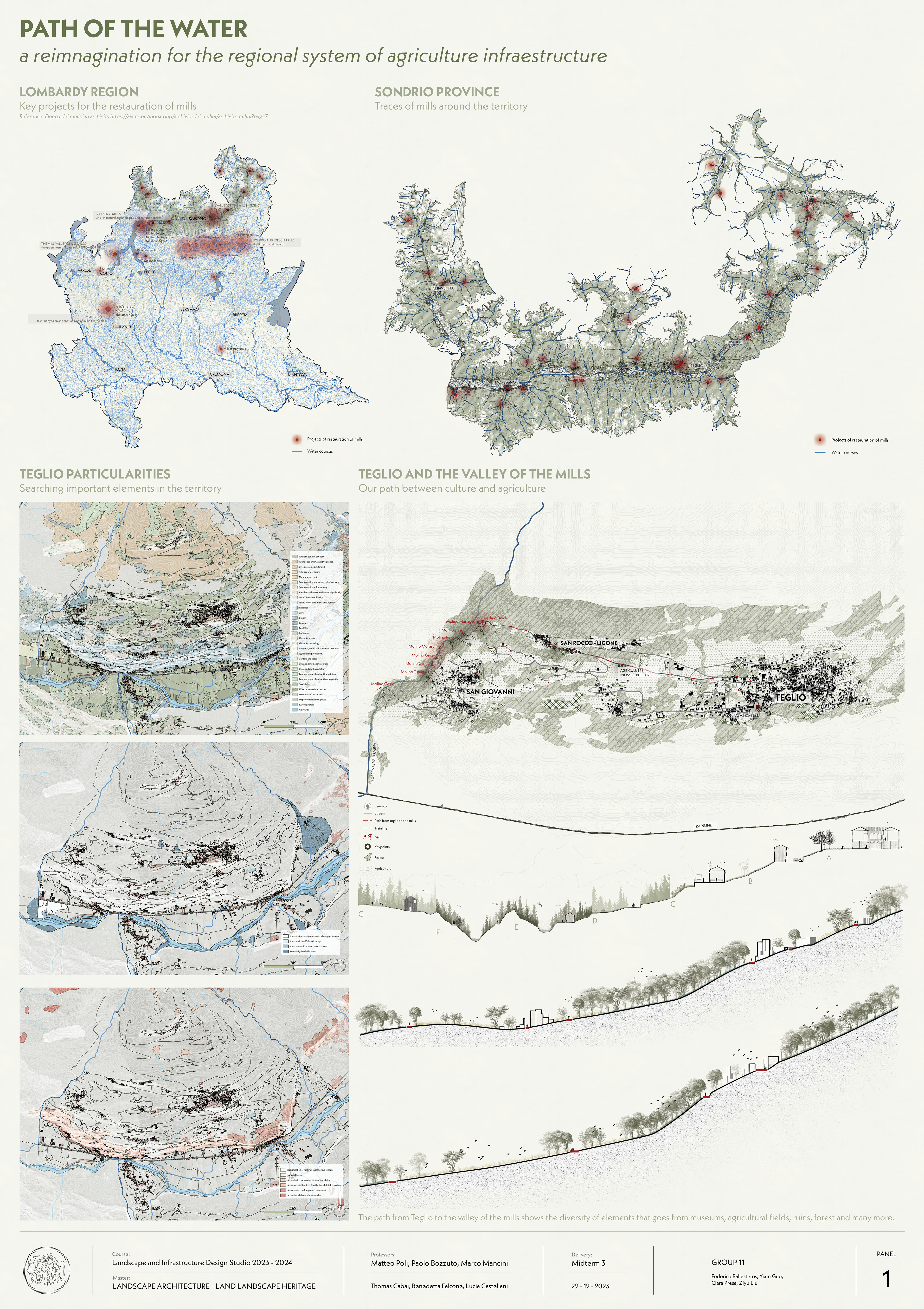
Teglio, is an Italian town of 4 436 inhabitants in the province of Sondrio in Lombardy, located in the middle Valtellina.
On a sun-soaked mountainside on Valtellina’s Rhaetian side of the valley, Teglio has long played a vital strategic role, with signs that are still visible today of the various eras of occupation to which it has been subjected – from the Romans to the Cisalpine Republic led by Napoleon Bonaparte, and the Lombards through to the Grisons.
Not just the revered home of Valtellina’s lauded local dish pizzoccheri, it’s also purportedly thanks to the might of Teglio that Valtellina got its name, with researchers tracing the etymology back to the curial Latin name of Vallis Tellina, meaning the Valley of Teglio.
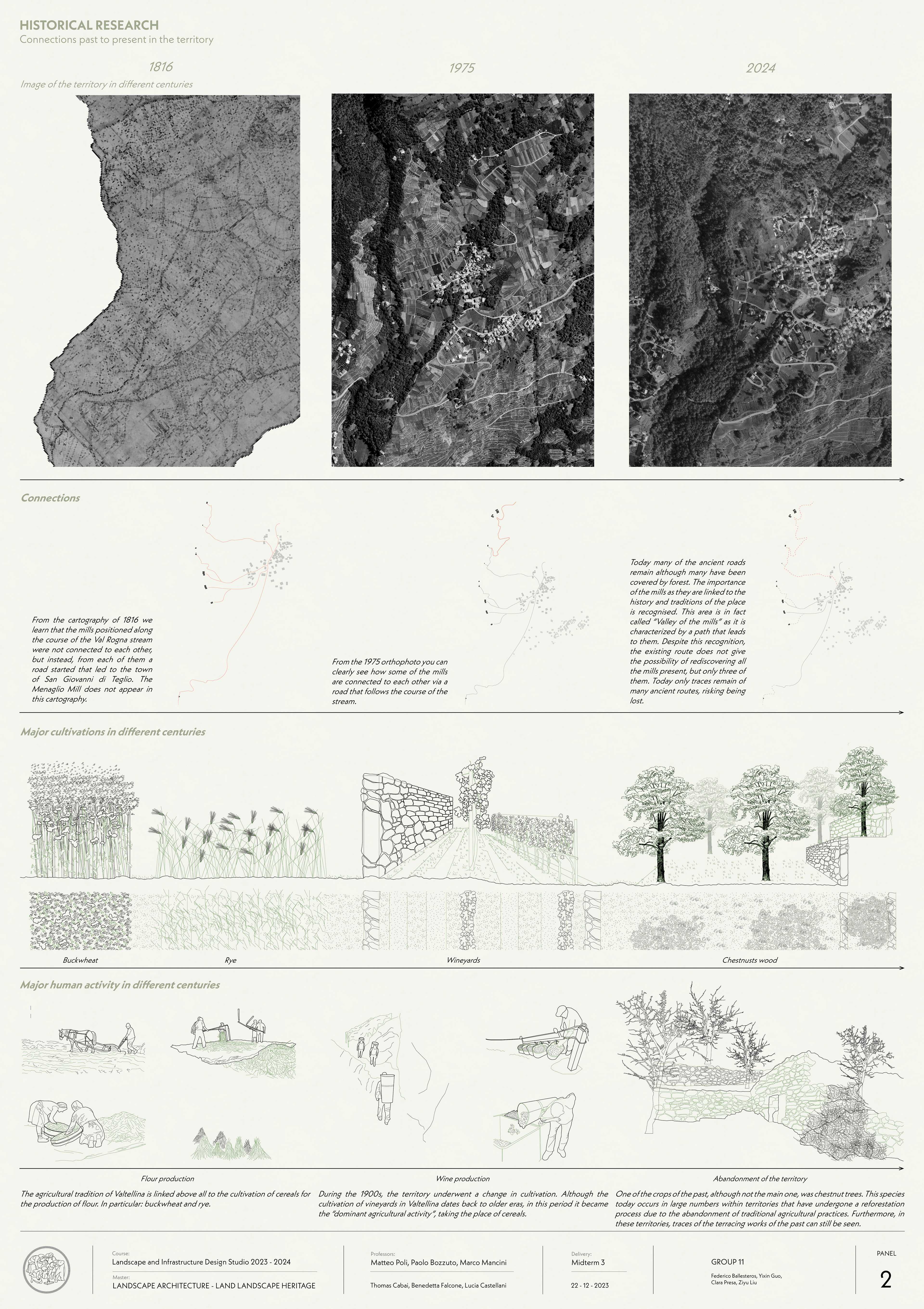
In the past, Teglio was a town with an economy almost exclusively focused on agriculture and livestock farming. The cultivation of buckwheat called “furmentùn”, “fraina” or “farina negra” was very representative, so much so that it became a Slow Food presidium . Buckwheat flour was and is used for Pizzoccheri ,Sciatt and many other dishes.
Currently the sector with the greatest growth is the tertiary sector, favored by the influx of many tourists during the summer and winter periods. Buckwheat (Fagopyrum esculentum), also locally called “Furmentùn”, “farina” or “negra flour”, belongs to the Chenopodiacee family and not to the Gramineous genus as the popular name would suggest. This variety is also gluten-free. It was introduced in Valtellina in 1600, today is one of its most characteristic crops.
Quite rustic, extremely resistant to cold climates and pests, it used to be grown to exploit the land in the summer months, after the winter harvest of rye, potatoes and barley. Its production peaked around 1800. Among its many outstanding features, Buckwheat grows well on low-yielding soils used for other crops, even on rocky ones. This is also why it proved vital for the local economy and the survival of the resident. After rye, it allowed the second yearly harvest from the same patch of land.
Following the annexation of Valtellina to Lombardy, things changed dramatically. The new contacts with the Po Valley, which had been previously limited, allowed the locals to buy much cheaper grain.
In the 1850s people started thinking about giving up buckwheat cultivation and the situation worsened in 1974 – 1975: back then, the decline of mountain agriculture began and, by the late 90s,
only 4-5 families of buckwheat farmers were still in business in Teglio (only one of them went on cultivating rye as well).
Today, few small crops have survived, while most of the products processed in Italy are imported from abroad. Still, thanks to the greater attention to local produce, the shortness of its crop cycle, and the popular request for gluten- free flour, buckwheat has been given a second chance in this
very area.
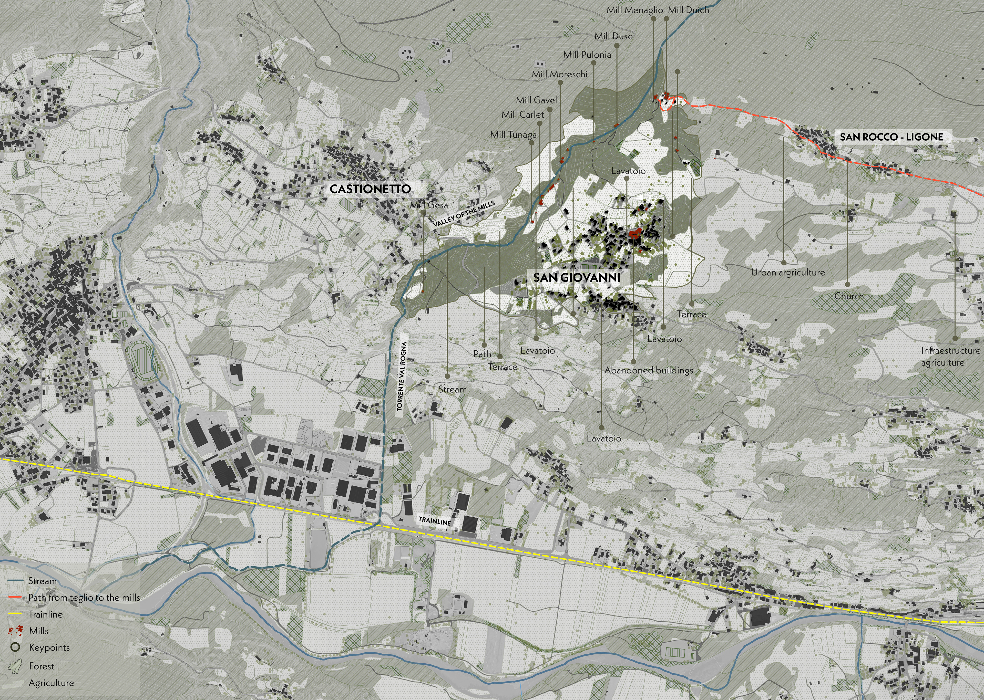
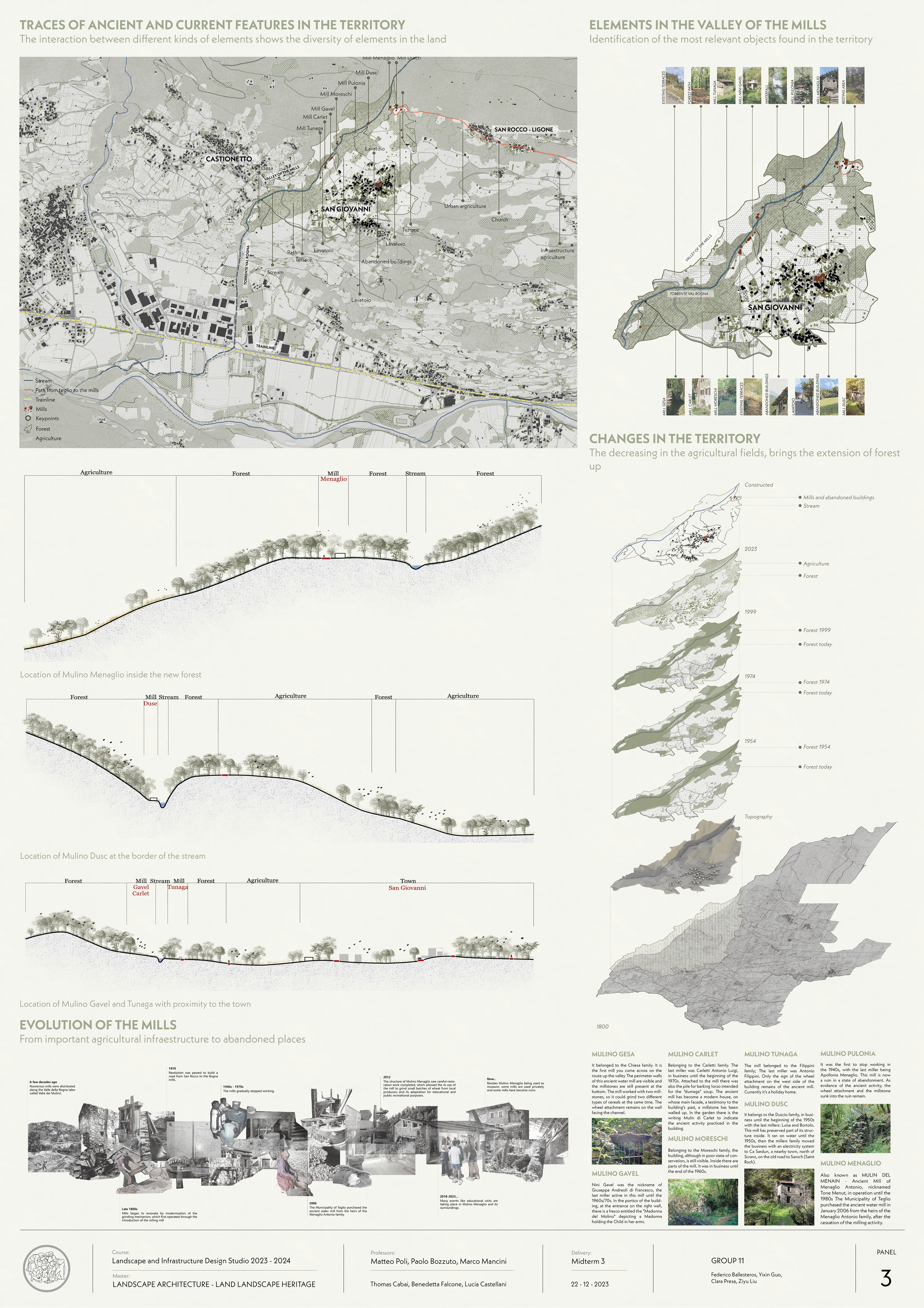
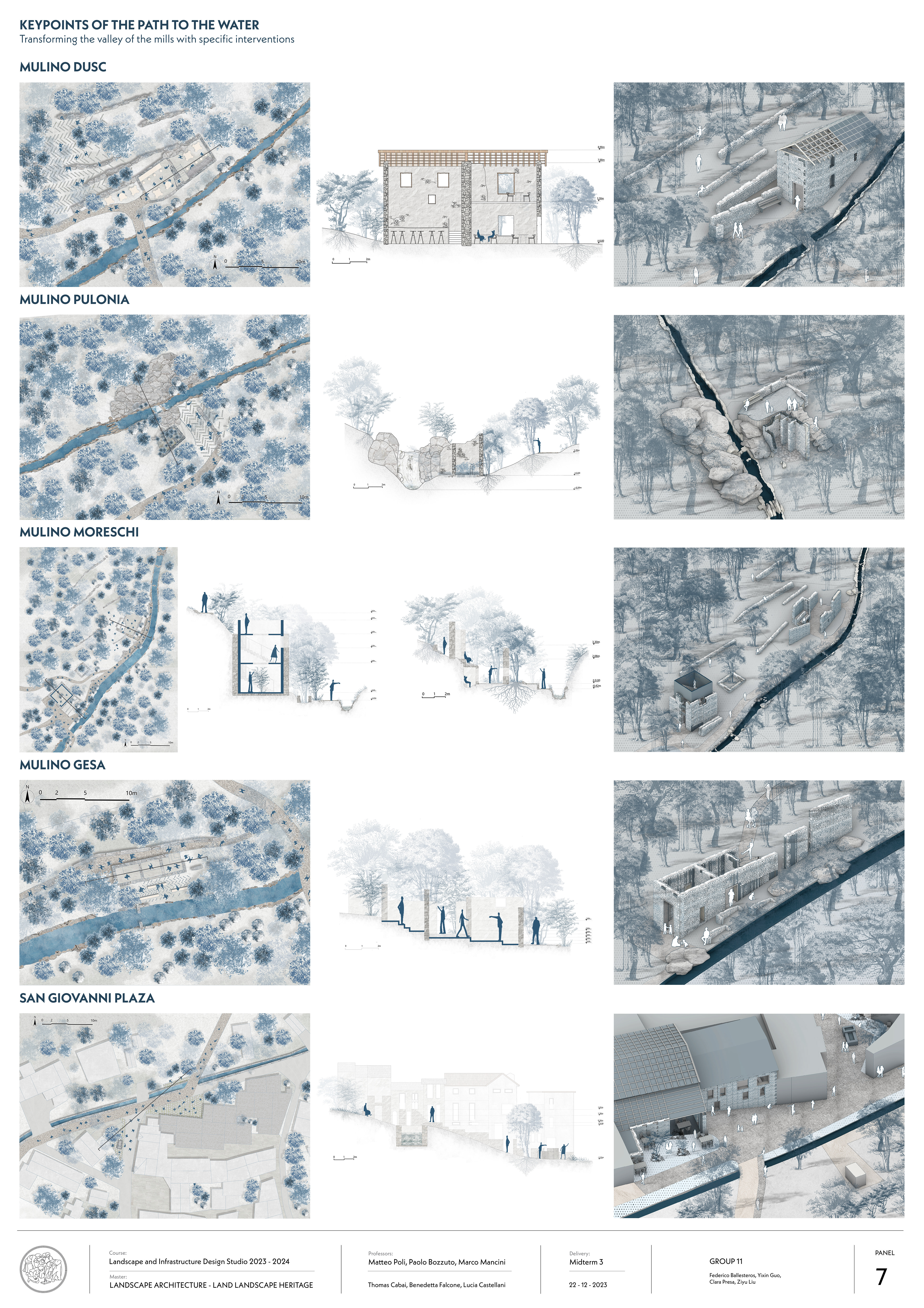
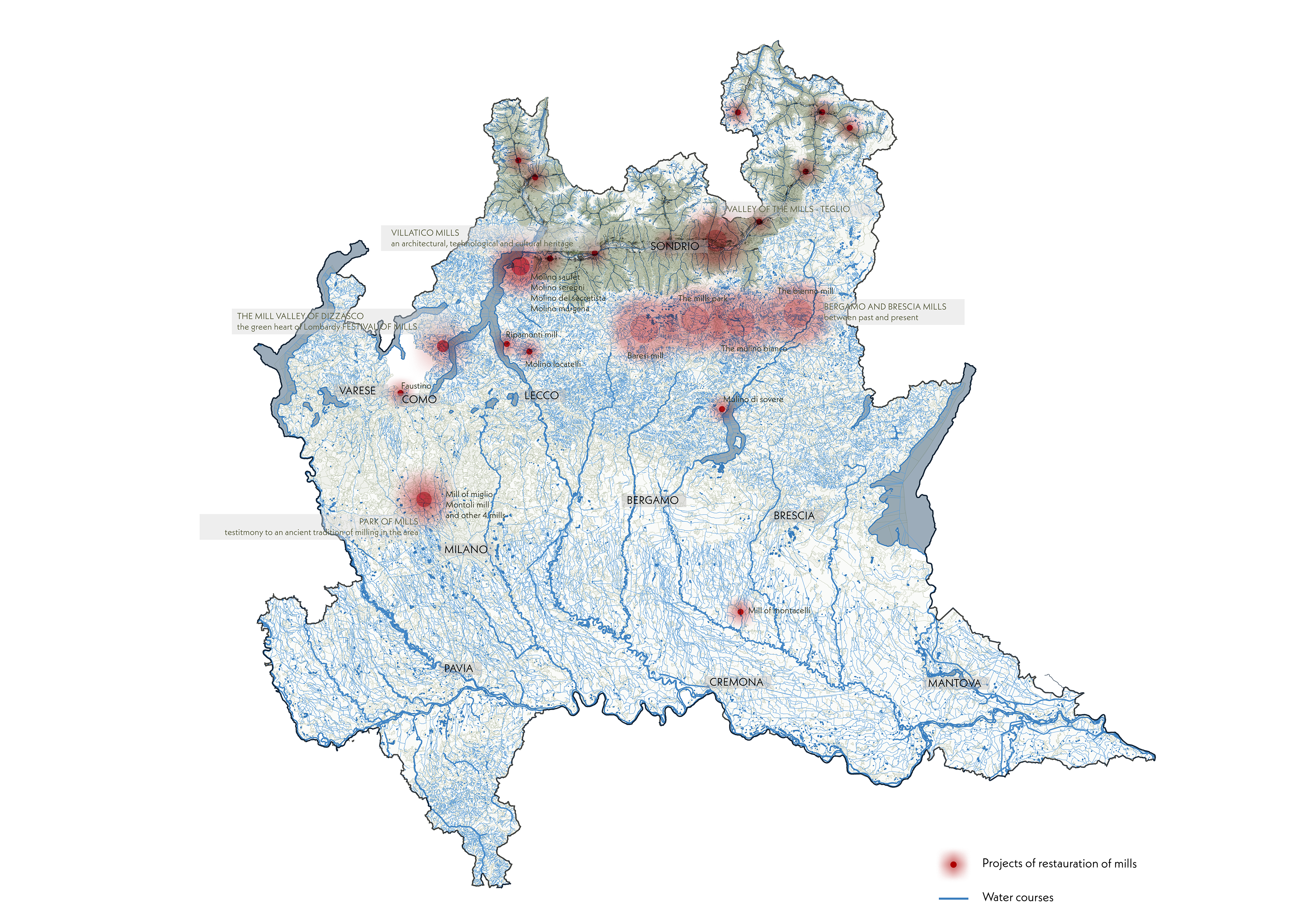
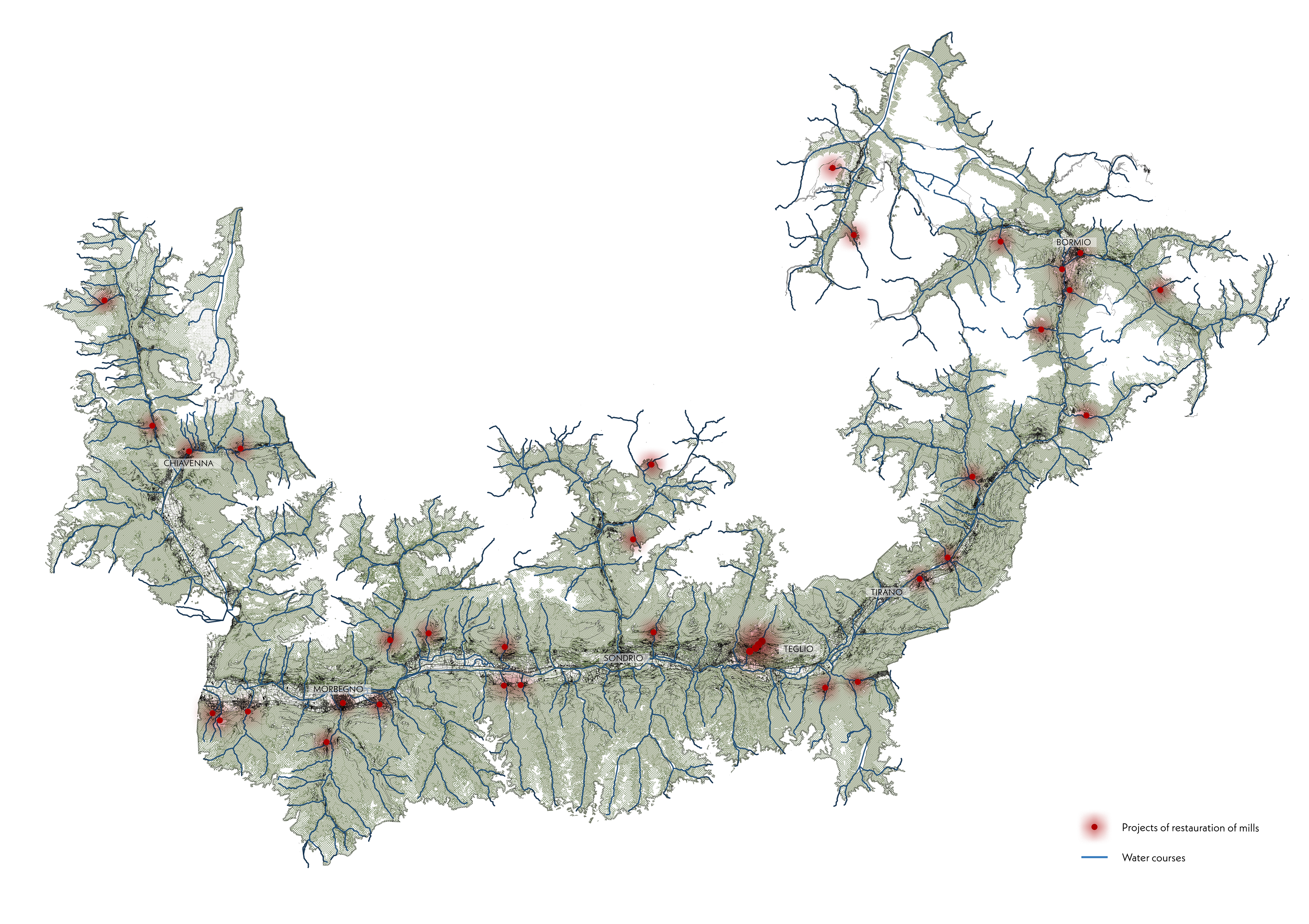
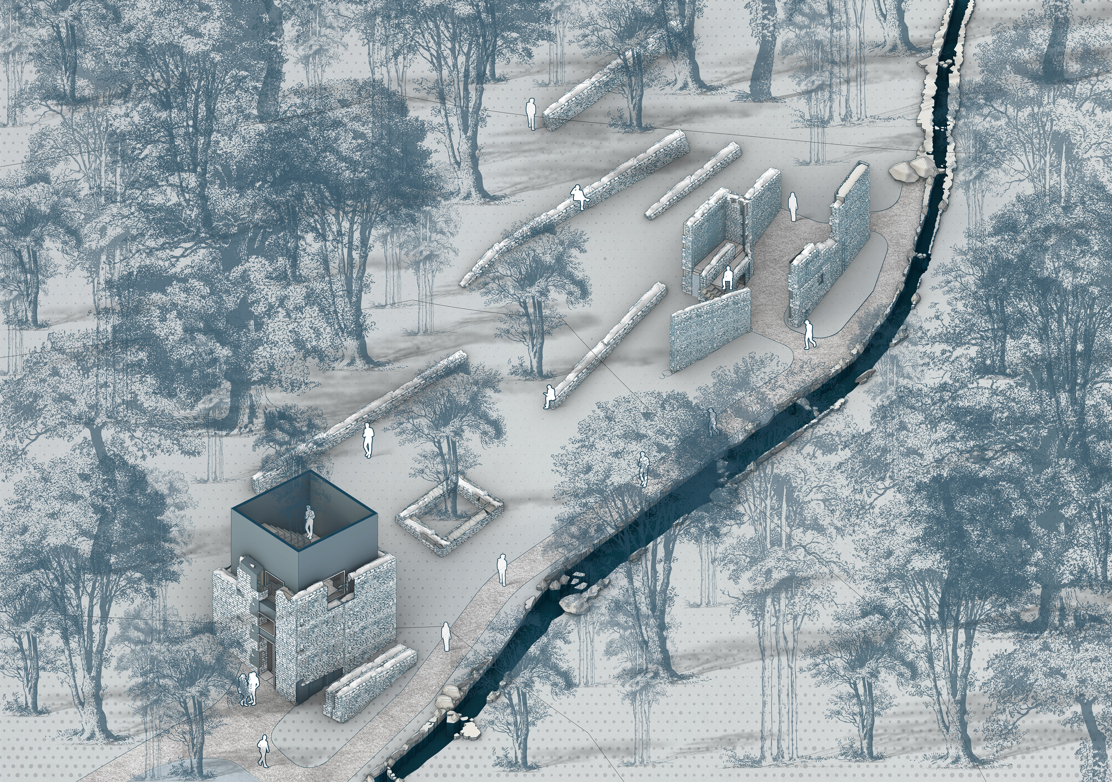
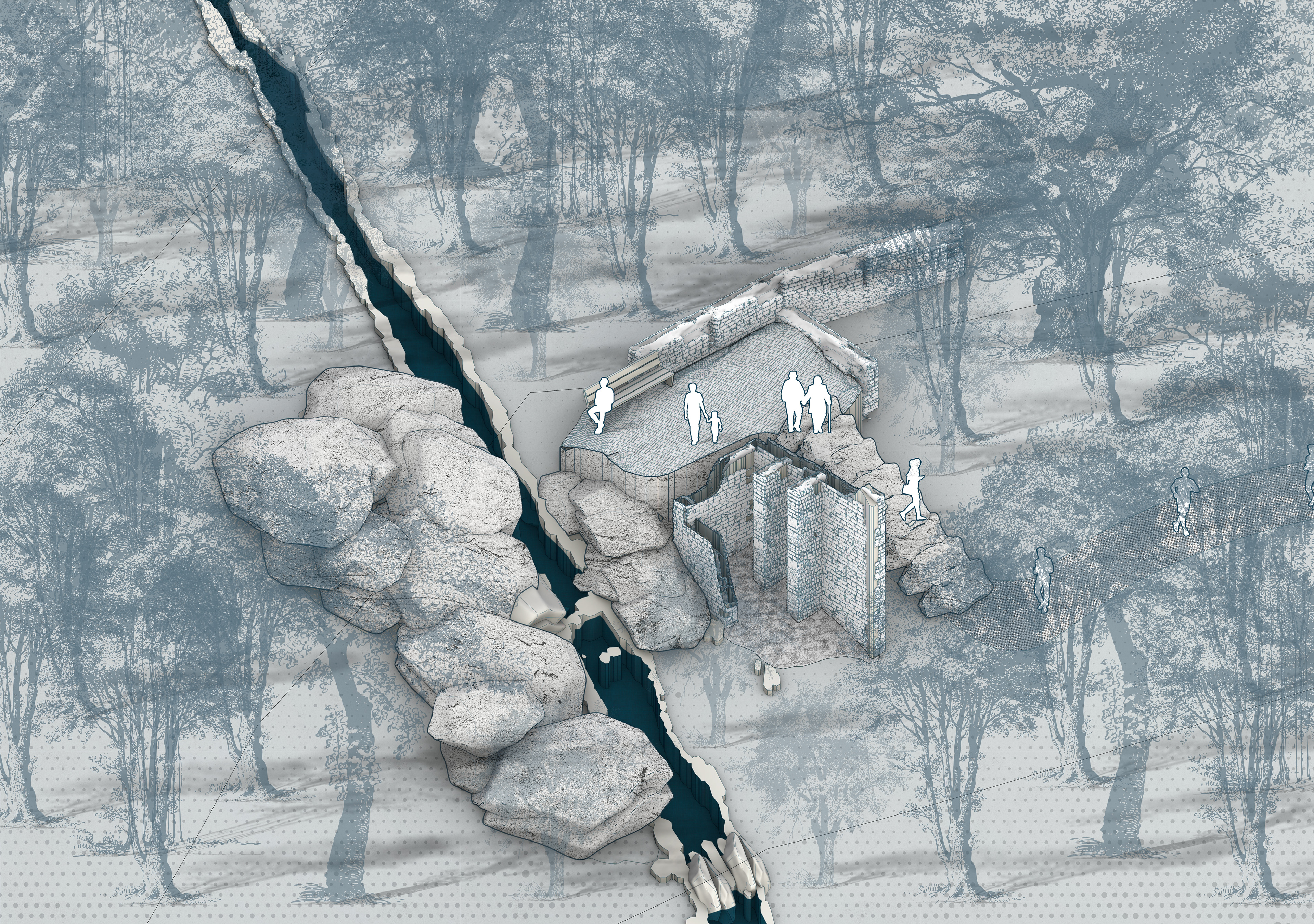
In Val Rogna, on the boundary with the municipality of Chiuro, on the left bank of the municipality of Teglio, traces are still visible of ten water mills that were in activity from the 17th to the 20th centuries. The toponym Rogna seems is refer to water, but also to the disputes between the two municipalities over its use, which was necessary to move the millstones. Water and mills are, in fact, the characteristic elements of the valley, immersed in luxuriant vegetation.
The statistical annals of the Province of Sondrio reveal that in 1886 “there were 523 mills for grinding cereals spread out over 72 municipalities, with a hydraulic force of 457 hp and employing around 800 workers”. The municipality with the most mills was Teglio, with no less than 38. This demonstrates how wheat, and rye in particular, was the fundamental element of a typical alpine diet, rich in fibres and poor in fats.
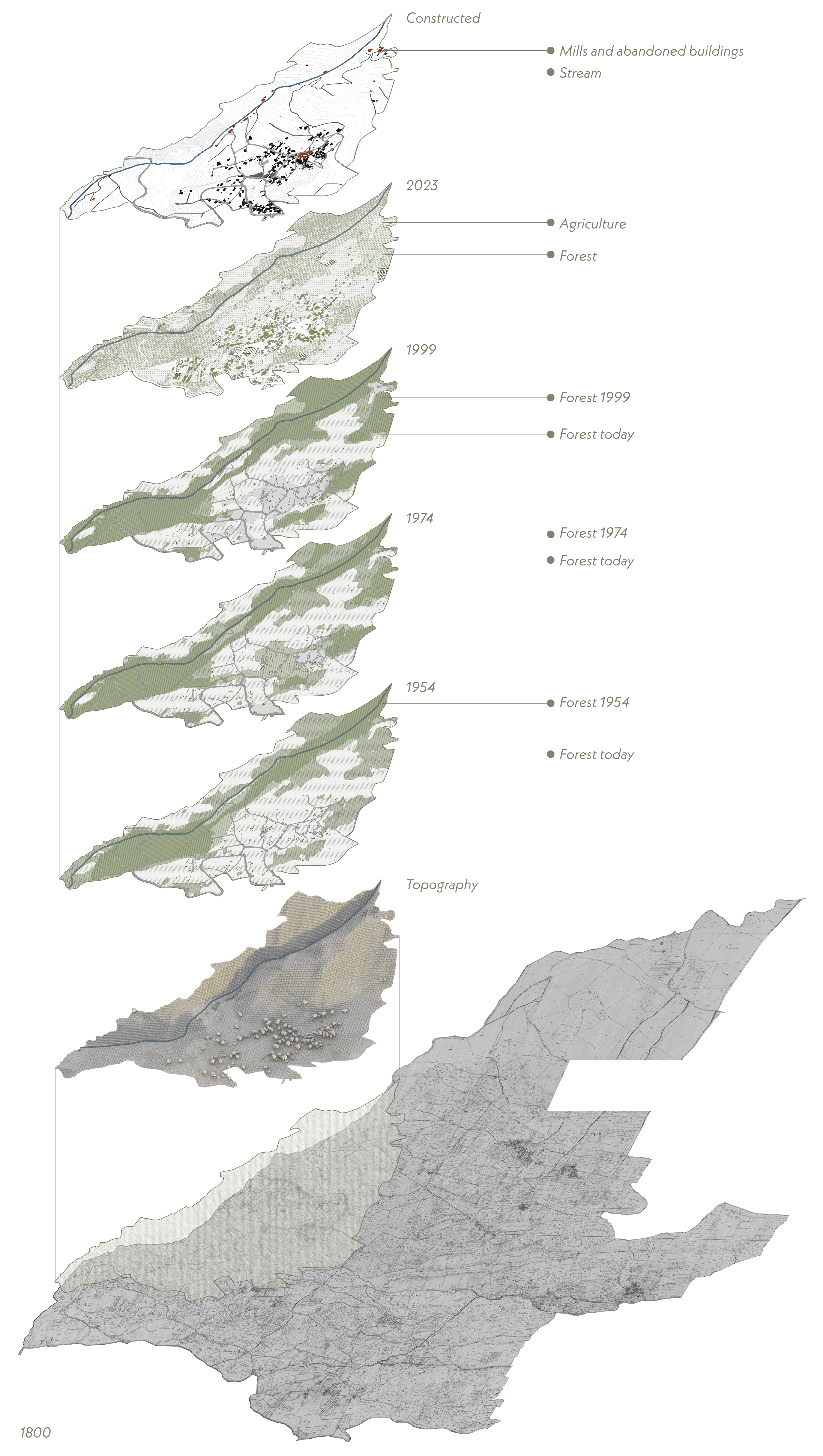
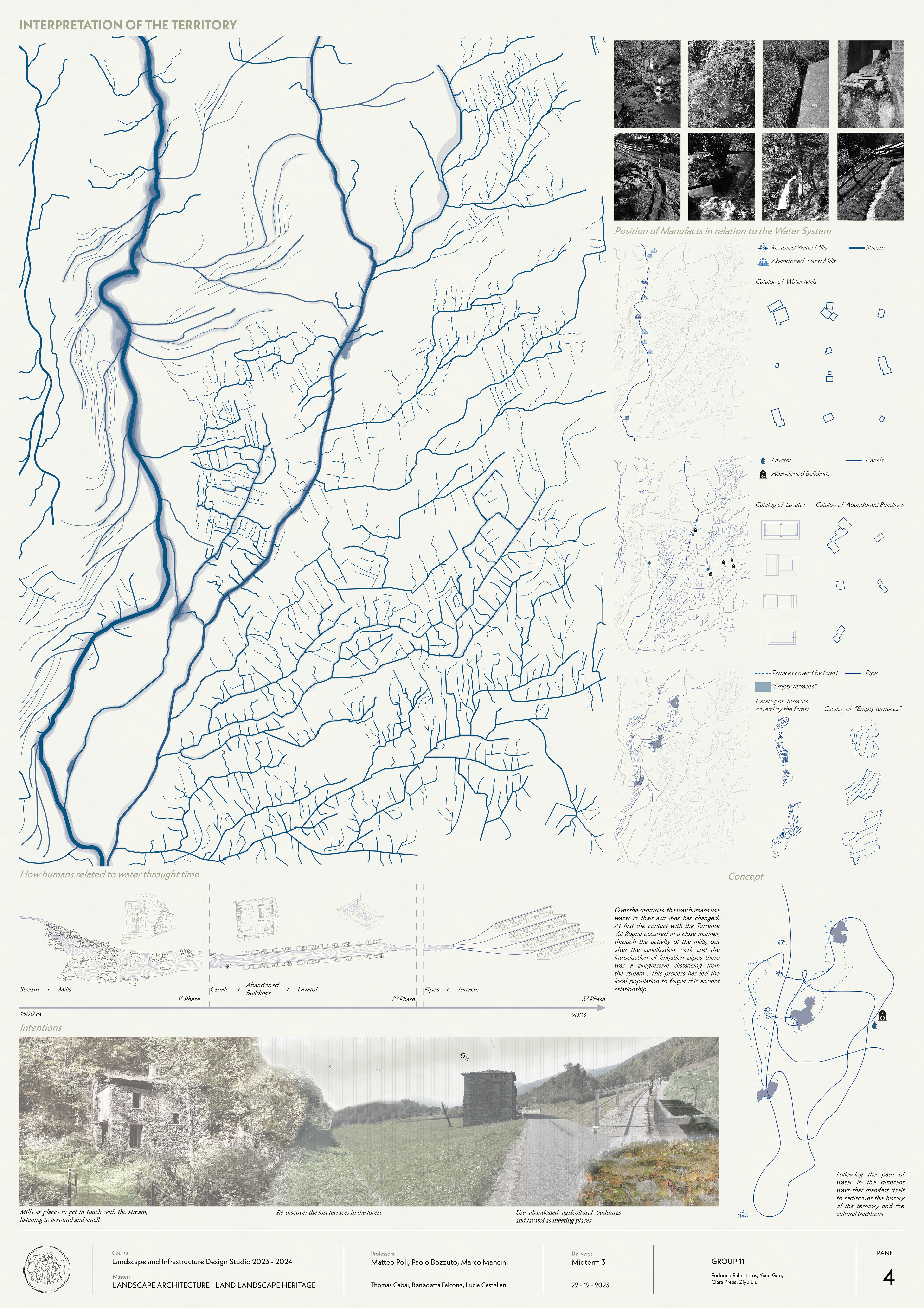
Over the centuries, the way humans use water in their activities has changed. At first the contact with the Torrente Val Rogna occurred in a close manner, through the activity of the mills, but after the canalisation work and the introduction of irrigation pipes there was a progressive distancing from the stream . This process has led the local population to forget this ancient relationship.
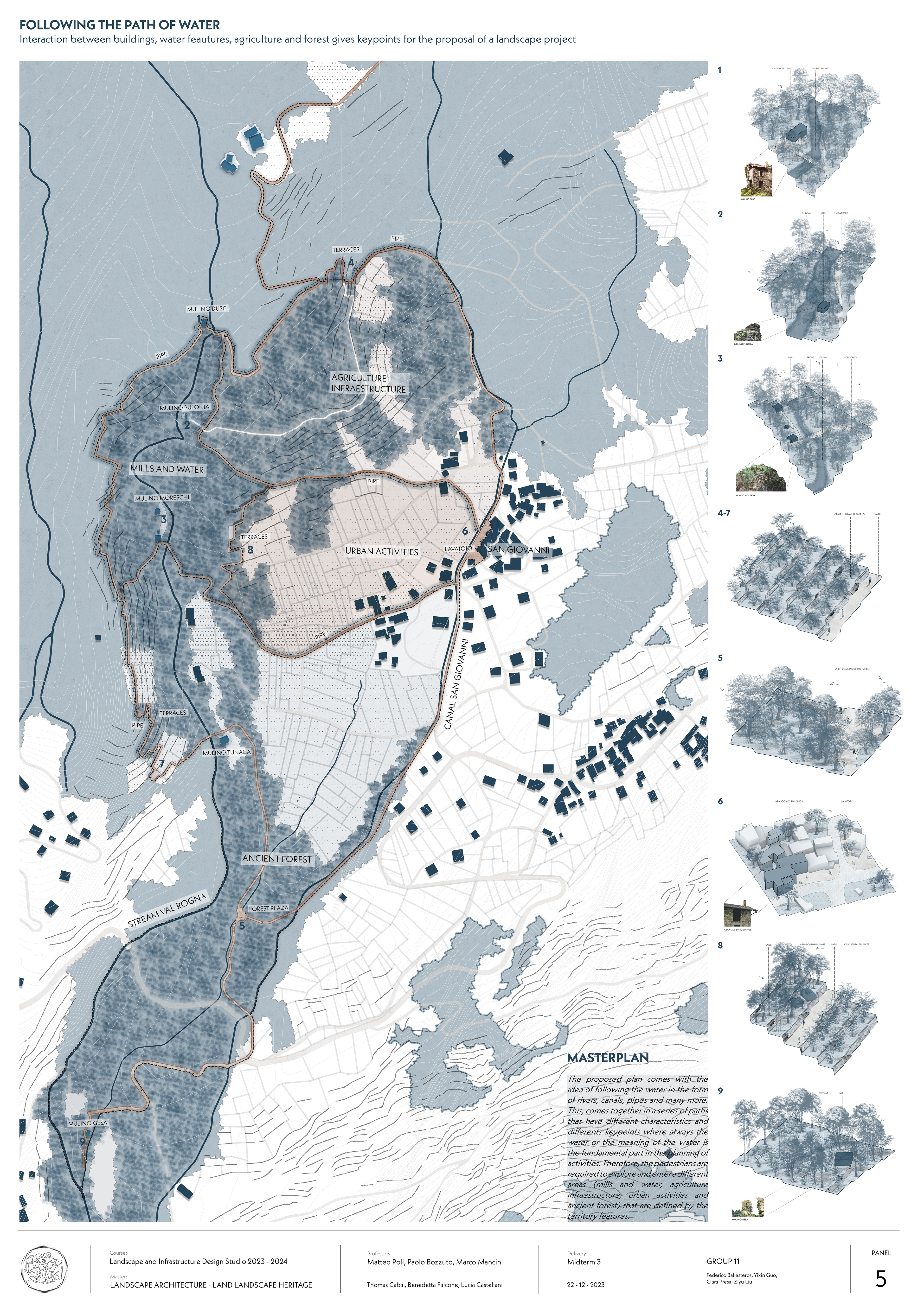
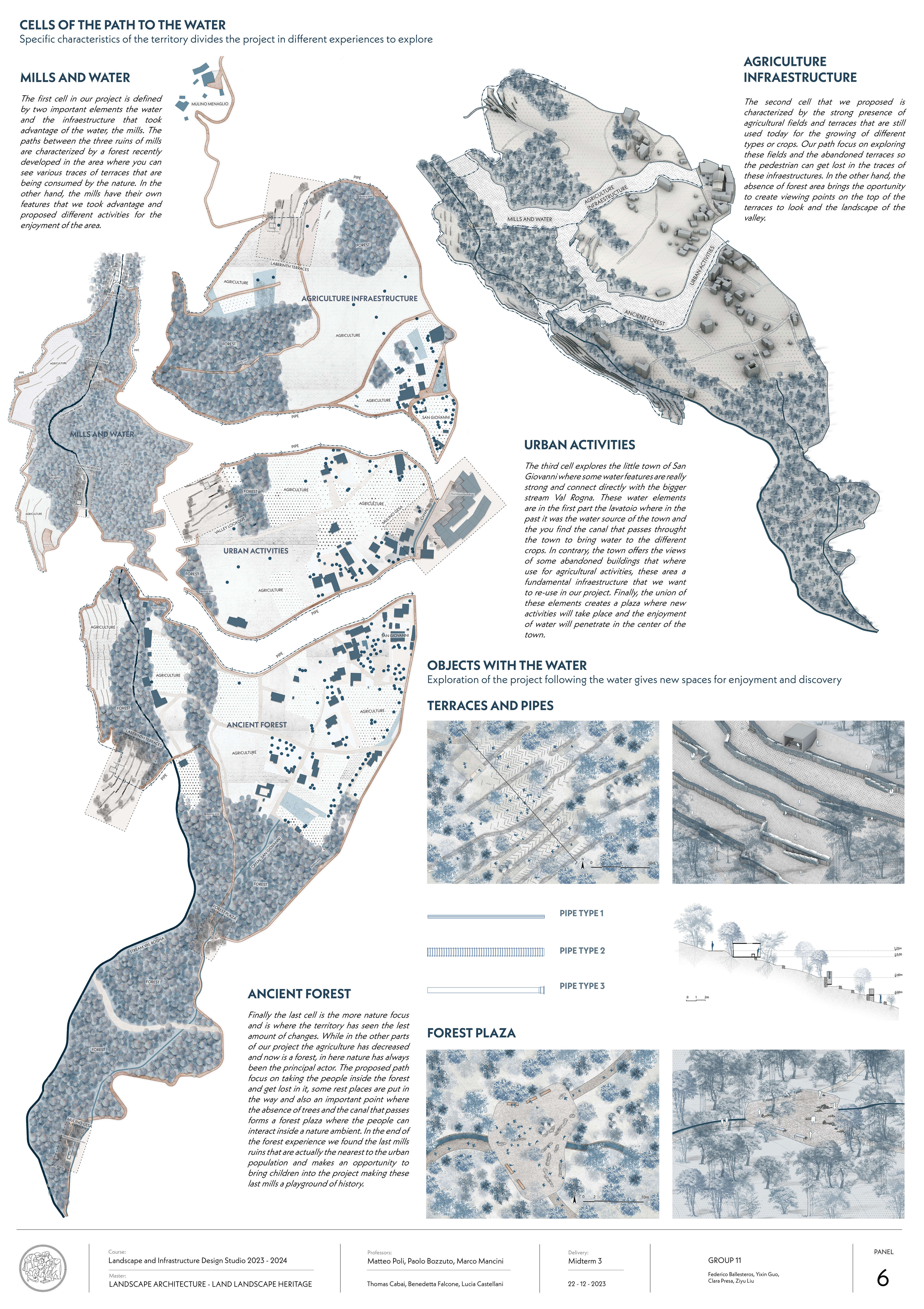
The proposed plan comes with the idea of following the water in the form of rivers, canals, pipes and many more. This, comes together in a series of paths that have different characteristics and differents keypoints where always the water or the meaning of the water is the fundamental part in the planning of activities. Therefore, the pedestrians are required to explore and enter a different areas (mills and water, agriculture infraestructure, urban activities and ancient forest) that are defined by the territory features.
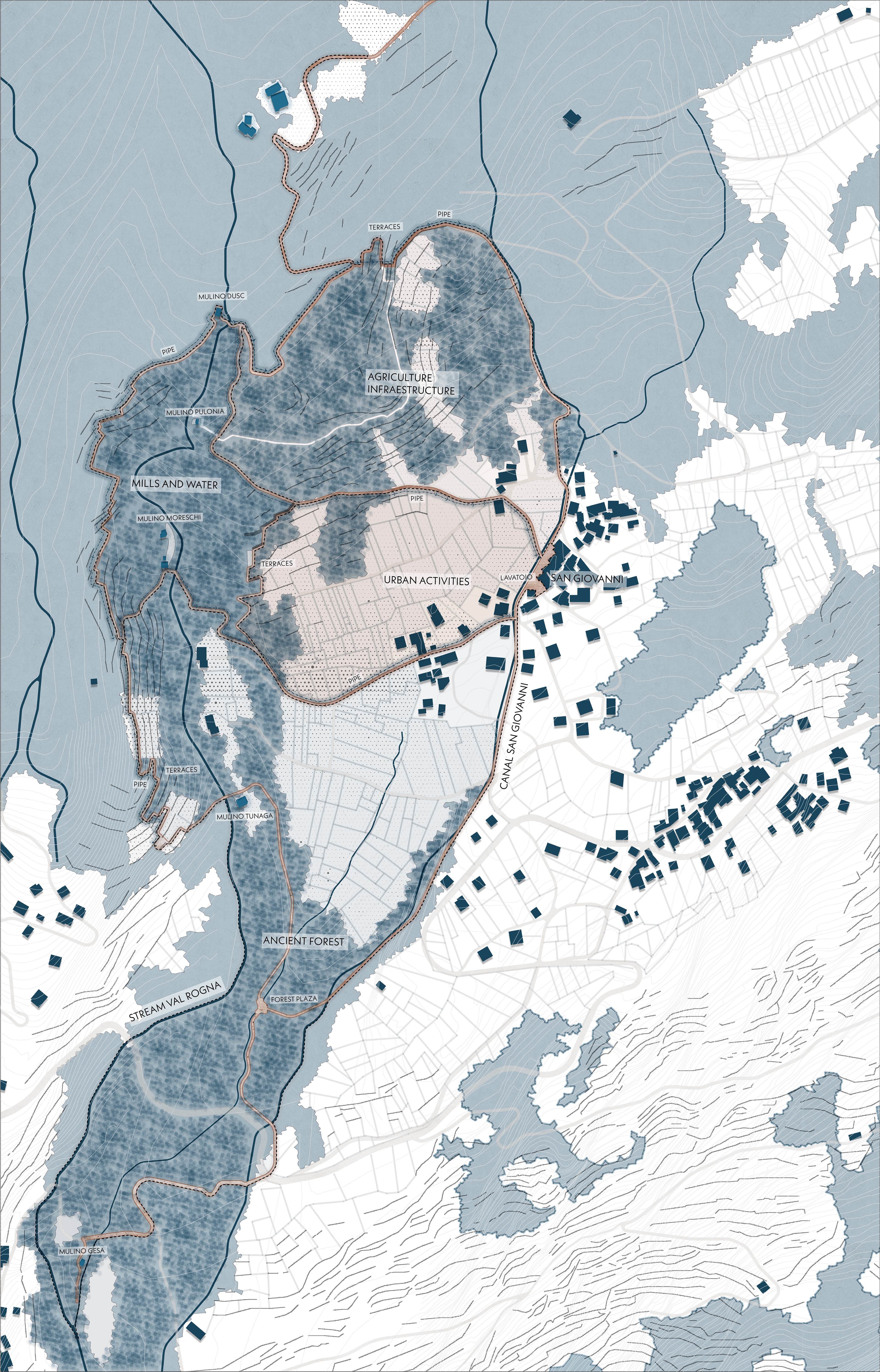
MILLS AND WATER
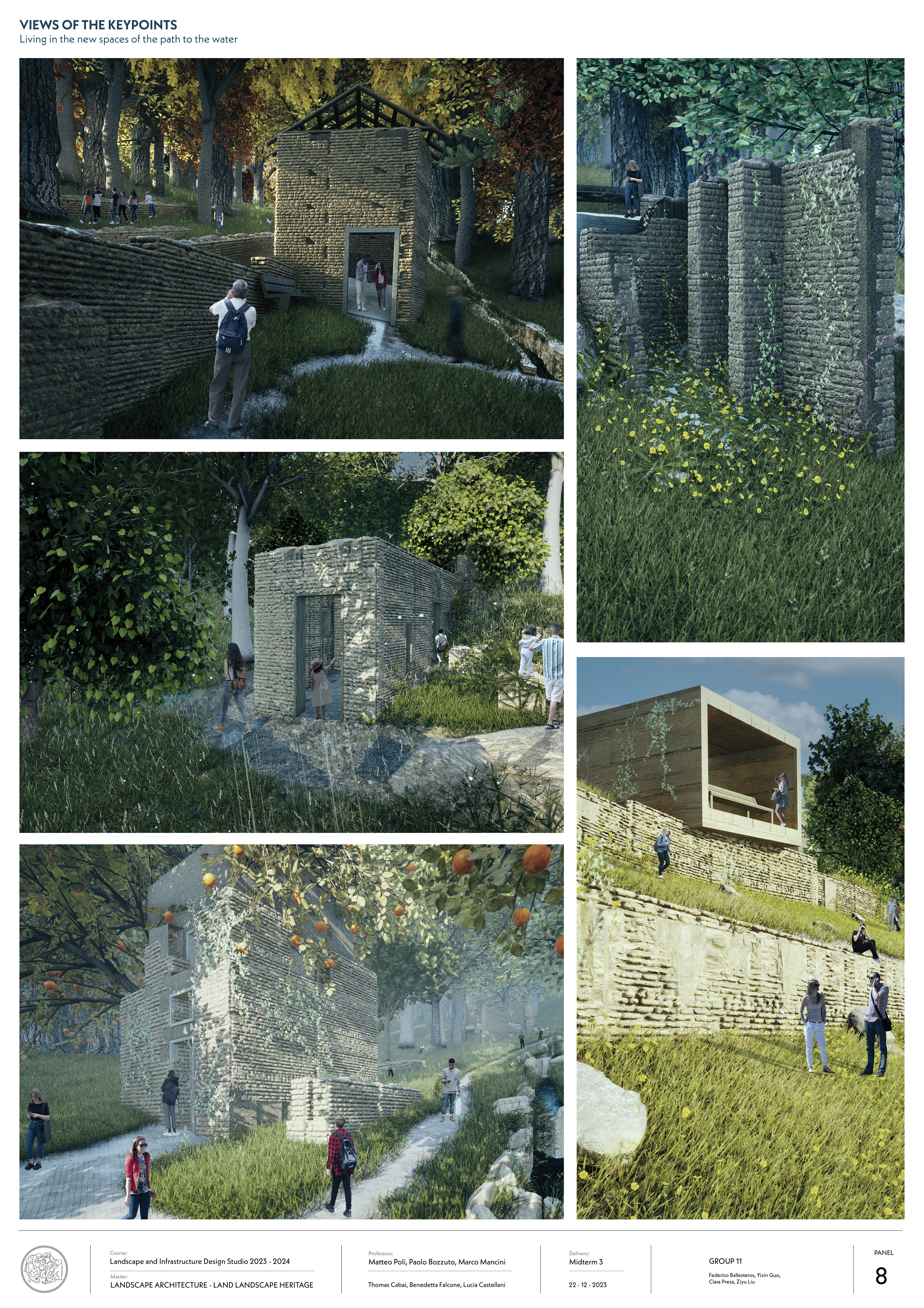
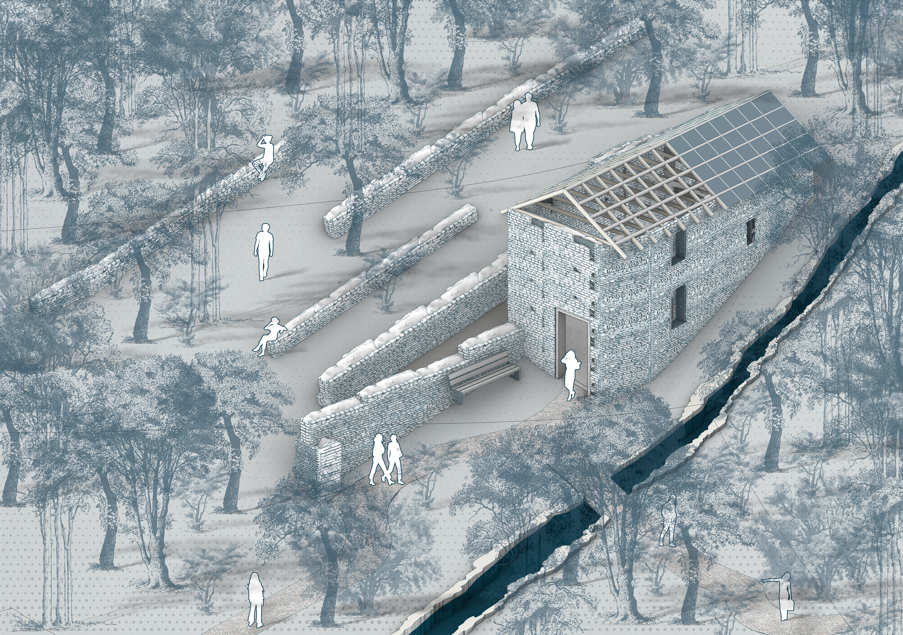
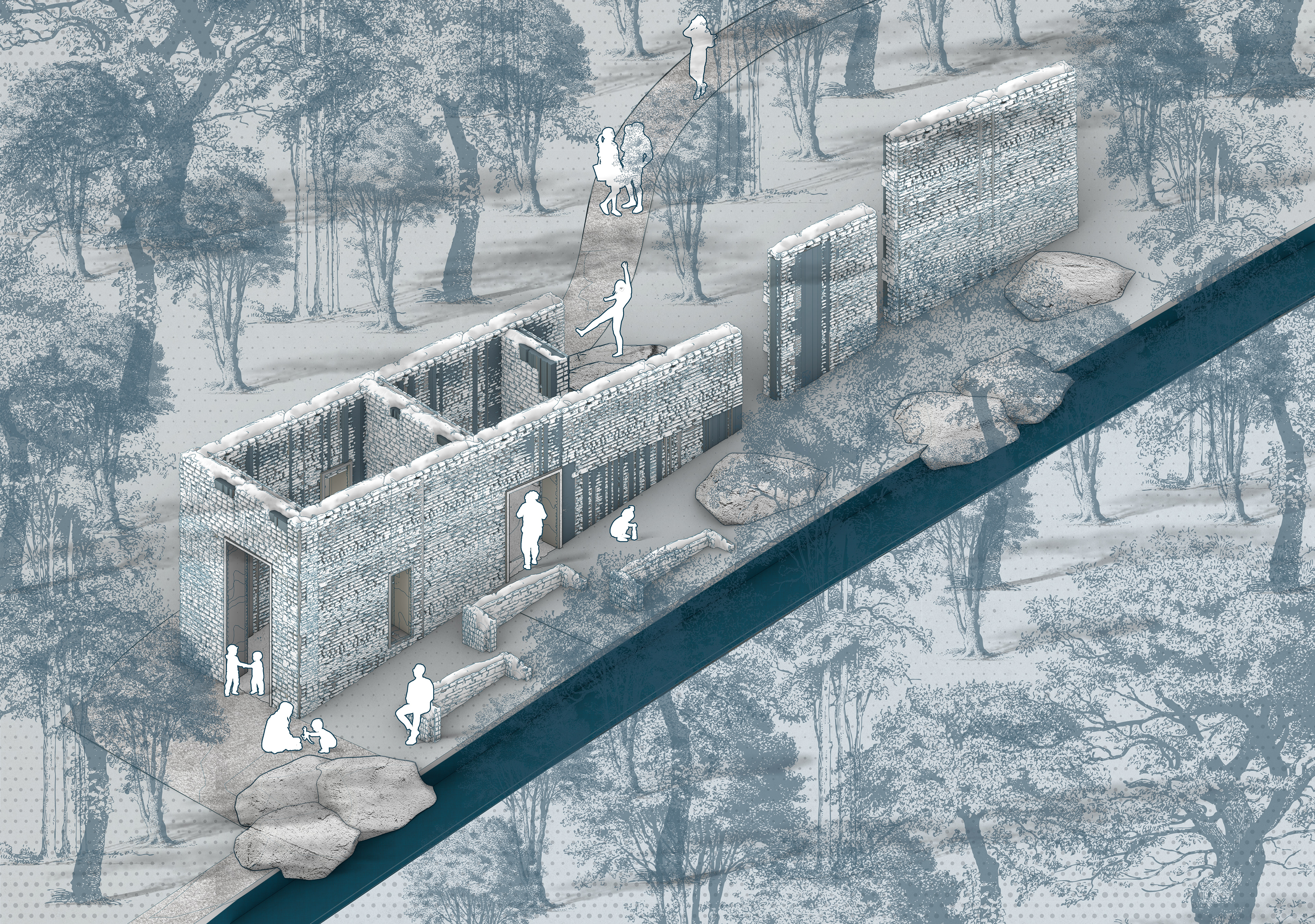
The first cell in our project is defined by two important elements the water and the infraestructure that took advantage of the water, the mills. The paths between the three ruins of mills are characterized by a forest recently developed in the area where you can see various traces of terraces that are being consumed by the nature. In the other hand, the mills have their own features that we took advantage and proposed different activities for the enjoyment of the area.
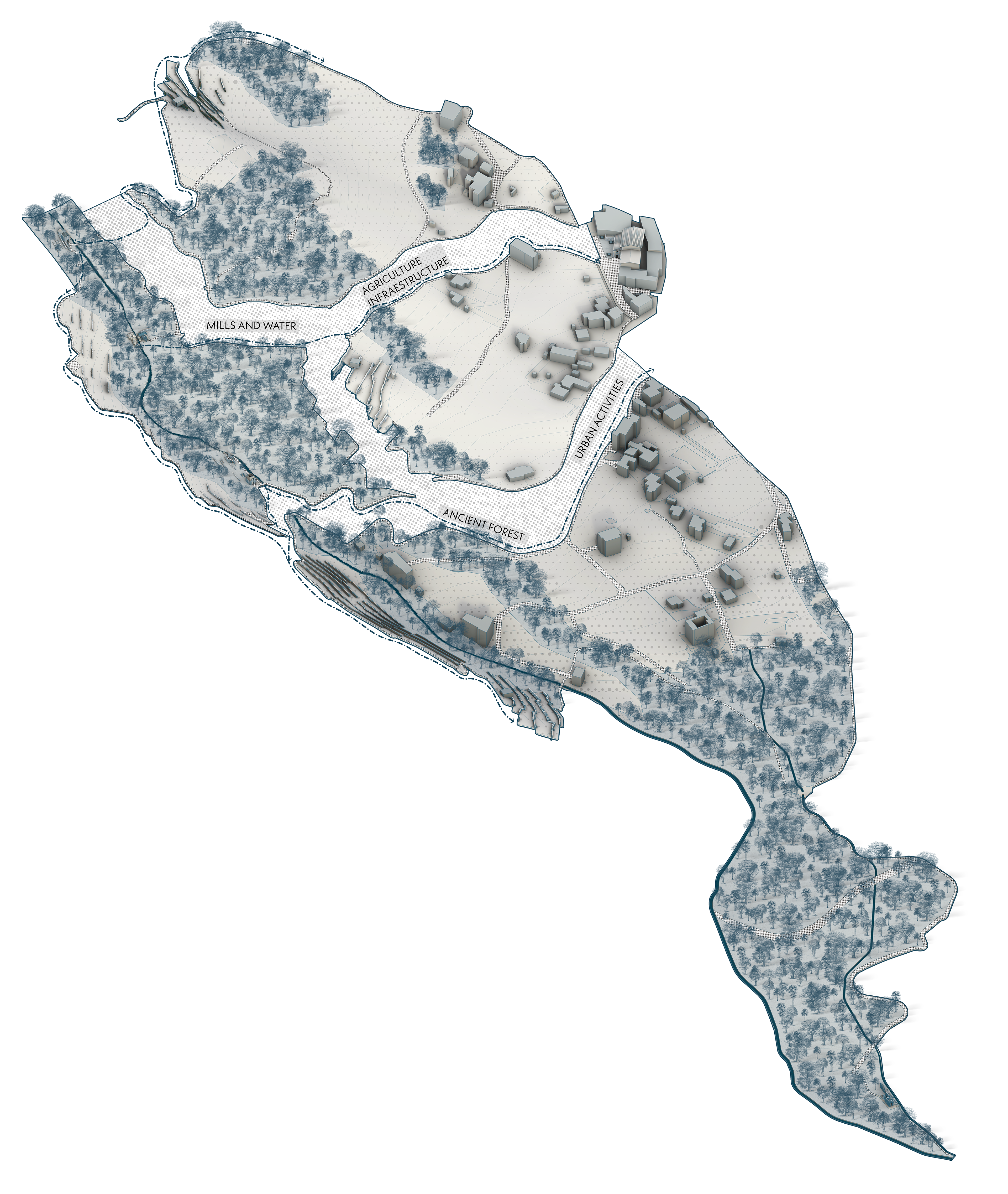
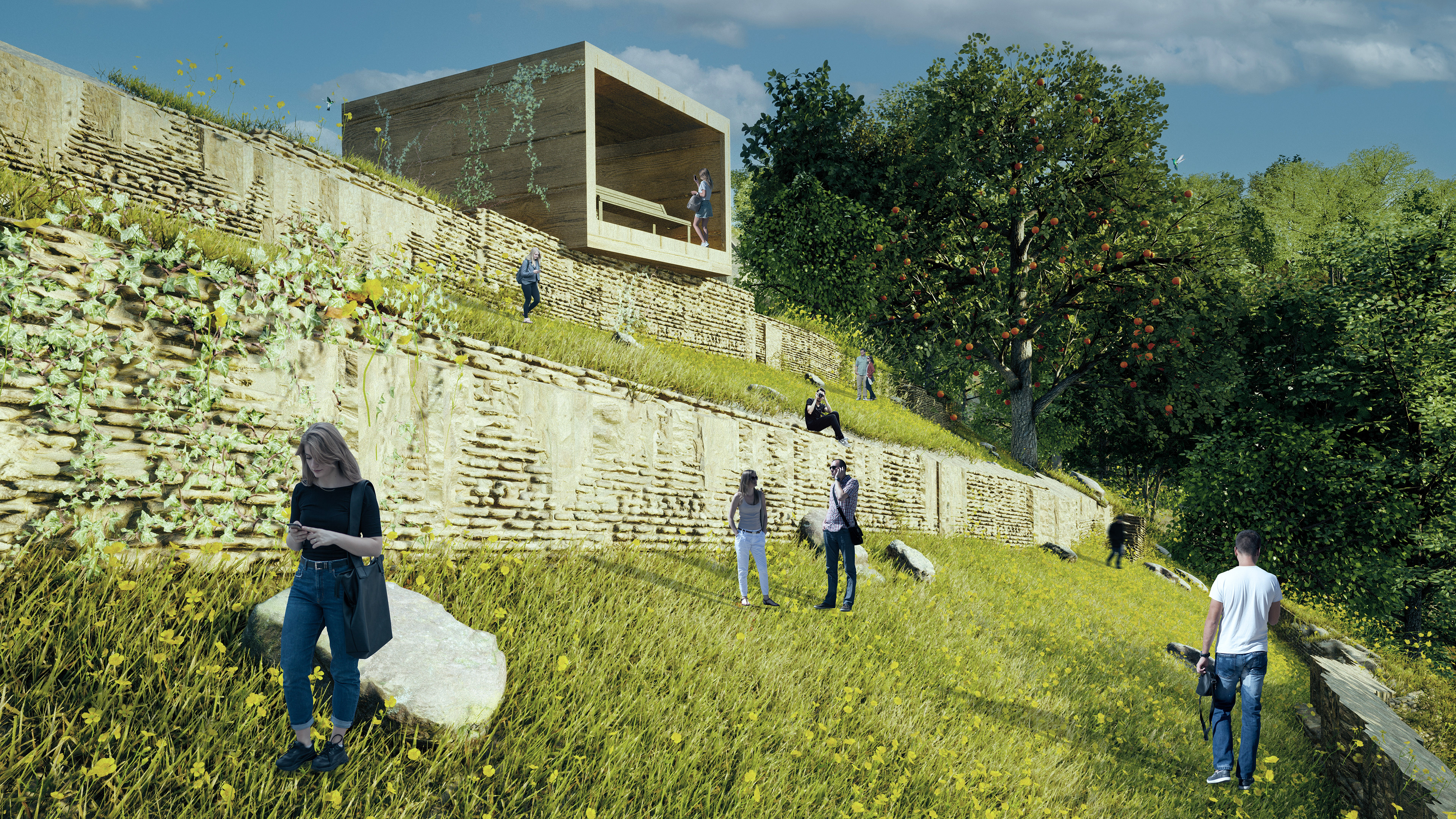
The second cell that we proposed is characterized by the strong presence of agricultural fields and terraces that are still used today for the growing of different types or crops. Our path focus on exploring these fields and the abandoned terraces so the pedestrian can get lost in the traces of these infraestructures. In the other hand, the absence of forest area brings the oportunity to create viewing points on the top of the terraces to look and the landscape of the valley.
URBAN ACTIVITIES
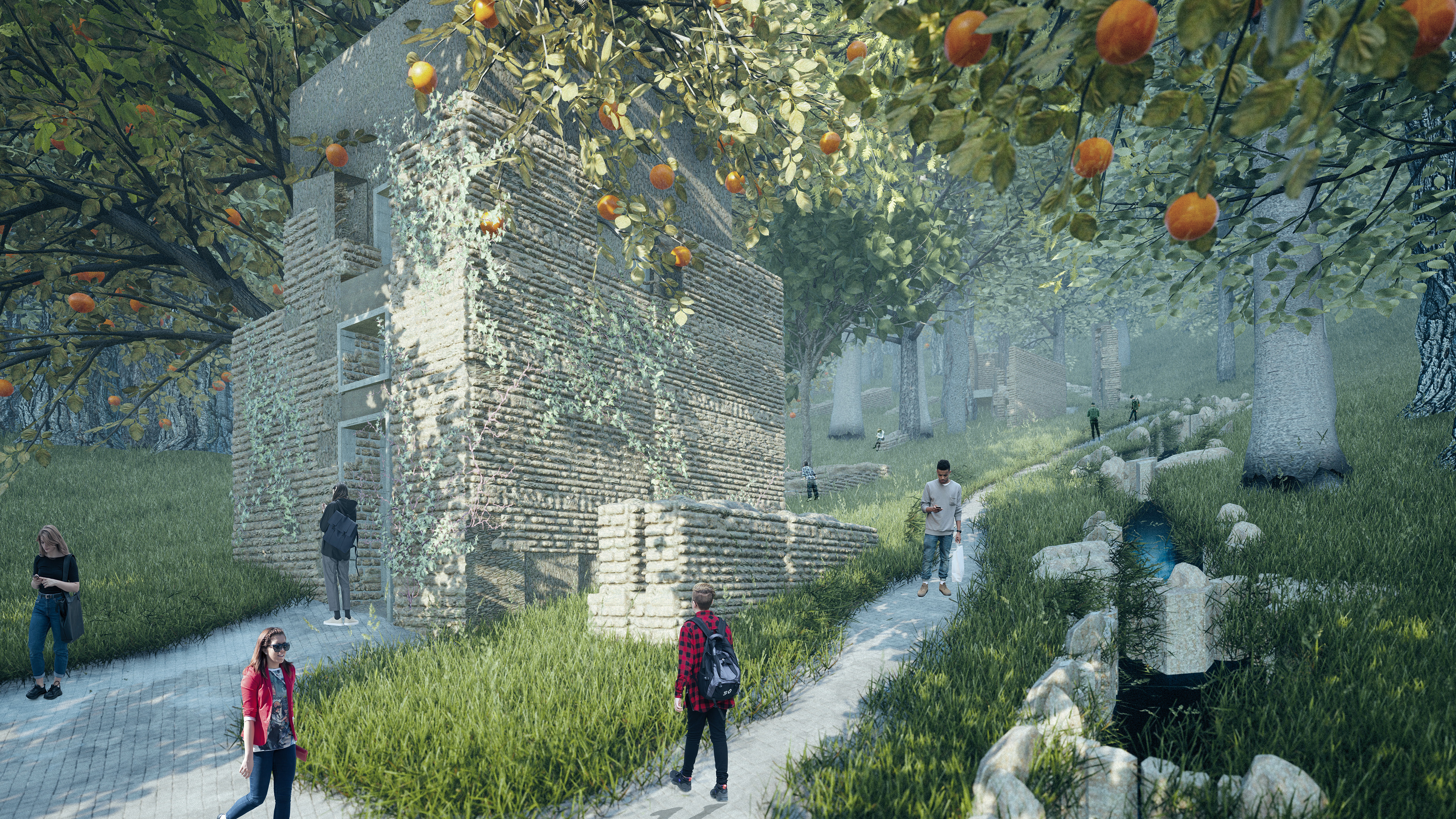
The third cell explores the little town of San Giovanni where some water features are really strong and connect directly with the bigger stream Val Rogna. These water elements are in the first part the lavatoio where in the past it was the water source of the town and the you find the canal that passes throught the town to bring water to the different crops. In contrary, the town offers the views of some abandoned buildings that where use for agricultural activities, these area a fundamental infraestructure that we want to re-use in our project. Finally, the union of these elements creates a plaza where new activities will take place and the enjoyment of water will penetrate in the center of the town.
ANCIENT FOREST
Finally the last cell is the more nature focus and is where the territory has seen the lest amount of changes. While in the other parts of our project the agriculture has decreased and now is a forest, in here nature has always been the principal actor. The proposed path focus on taking the people inside the forest and get lost in it, some rest places are put in the way and also an important point where the absence of trees and the canal that passes forms a forest plaza where the people can interact inside a nature ambient. In the end of the forest experience we found the last mills ruins that are actually the nearest to the urban population and makes an opportunity to bring children into the project making these last mills a playground of history.
PANELS